My Brother Sam is Dead Maps of Redding,
CT

Map of Redding that relates to My Brother
Sam is Dead.
Google Map of Redding with information about My Brother Sam is Dead
added
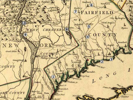
1780 Map of West Chester and Fairfield
County showing Redding, Ridgebury, Salem, Verplanck Point.
Click here to view a larger version of this map with locations
mentioned in the novel.
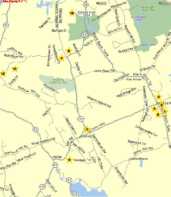
Numbered and Labeled Map of People and
Places related to My Brother Sam is Dead:
1. Meeker's Tavern
2. Lt. Stephen Betts/Parsons' Headquarters
3. Jerry Sanford
4. Anglican Church
5. William Heron
6. Ned's house (where Ned lived)
7. Presbyterian Church
8. Col. John Read and Betsy Read's
House
9. Tom Warrups' Hut
10. Putnam Park, main encampment
11. Second Camp, Gen. Parsons'
encampment
12. Gallows Hill, site of Sam's
execution
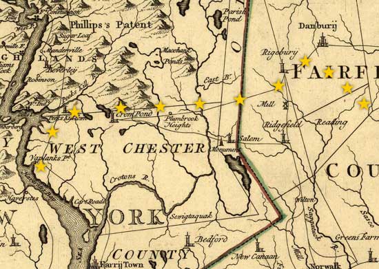
Map with stars showing Tim and Life's
cattle drive route to Verplancks Point
|